
Milledgeville, Georgia
Milledgeville, Georgia | |
|---|---|
City | |
| City of Milledgeville | |
 | |
 Flag  Seal | |
| Motto(s): "Capitols, Columns and Culture" | |
 Location in Baldwin County and the state of Georgia | |
 Milledgeville Location of Milledgeville in the US | |
| Coordinates: 33°5′16″N 83°14′0″W / 33.08778°N 83.23333°W | |
| Country | United States |
| State | |
| County | Baldwin |
| Incorporated | December 12, 1804 |
| Named after | John Milledge |
| Government | |
| • Type | Council–Manager |
| • Mayor | Mary Parham-Copelan |
| • Manager | Hank Griffeth |
| • Council | Members
|
| Area | |
• Total | 20.48 sq mi (53.05 km2) |
| • Land | 20.32 sq mi (52.63 km2) |
| • Water | 0.16 sq mi (0.42 km2) |
| Elevation | 330 ft (100 m) |
| Population (2020) | |
• Total | 17,070 |
| • Density | 839.98/sq mi (324.31/km2) |
| Time zone | UTC−5 (Eastern Time) |
| • Summer (DST) | UTC−4 (EDT) |
| ZIP Code | 31061 |
| Area code | 478 |
| FIPS code | 13-51492[3] |
| GNIS feature ID | 0332390[4] |
| Website | milledgevillega |
Milledgeville is a city in and the county seat of Baldwin County in the U.S. state of Georgia.[5] It is northeast of Macon, bordered on the east by the Oconee River. The rapid current of the river here made this an attractive location to build a city. It was the capital of Georgia from 1804 to 1868, including during the American Civil War. Milledgeville was preceded as the capital city by Louisville and was succeeded by Atlanta, the current capital. Today U.S. Highway 441 connects Milledgeville to Madison, Athens, and Dublin.
As of April 1, 2020, the population of Milledgeville was 17,070, down from 17,715 at the 2010 U.S. census.[6]
Milledgeville is along the route of the Fall Line Freeway, which links Milledgeville with Augusta, Macon, Columbus, and other Fall Line cities. They have long histories from the colonial era of Georgia.
Milledgeville is the principal city of the Milledgeville micropolitan statistical area, a micropolitan area that includes Baldwin and formerly Hancock county until 2023.[7] It had a population of 43,799 at the 2020 census.[3] The Old State Capitol is located here; it was added to the National Register of Historic Places (NRHP). Much of the original city is contained within the boundaries of the Milledgeville Historic District, which was also added to the NRHP.
History
[edit]This section needs additional citations for verification. (January 2018) |
Milledgeville served as Georgia’s state capital from 1804 to 1868 and played a central role in shaping the state’s early development.[8] Established during a period of territorial expansion following treaties with the Muscogee (Creek) Nation, the city became the state's center of political activity and remained so through the American Civil War, after which the capital was relocated to Atlanta.[9] In the decades that followed, Milledgeville responded to the challenges of losing its capital status by expanding public institutions and higher education and, more recently, by investing in economic diversification and downtown revitalization.[9][10]
Milledgeville, named for Georgia governor John Milledge (1802–1806), was established in 1804 as Georgia’s new centrally located capital.[8] Its founding followed the 1802 Treaty of Fort Wilkinson, through which the Muscogee (Creek) Nation ceded land west of the Oconee River to the state.[11] Prior to this, the area had been the subject of prolonged conflict between settlers and the Creek Nation, including violent clashes known as the Oconee War.[9] Planned as a grid-based city similar to Savannah, Georgia and Washington, D.C., Milledgeville quickly rose in prominence, serving as Georgia's capital for over six decades until 1868.[12]
Life in the antebellum capital
[edit]As Georgia’s capital, Milledgeville grew into a hub of political activity and cotton-based commerce in the decades leading up to the American Civil War.[12] The city's economic expansion was built in part on the labor of enslaved people, who worked on plantations and within the town as domestic workers, skilled tradespeople, and general laborers.[8] By 1828, nearly half of Milledgeville's 1,599 residents were enslaved; only 27 identified as free Black residents.[9]

Milledgeville continued to expand with the addition of major state institutions, including a penitentiary and the Georgia State Lunatic, Idiot, and Epileptic Asylum (now Central State Hospital).[13][12] Taverns, hotels, shops, banks, and newspapers also emerged during this period,[14][9] and in 1838, Oglethorpe University was founded as one of Georgia's earliest chartered colleges.[15] As Milledgeville developed, its appearance began to shift from a frontier town to a more established capital with larger, more refined buildings. Among these were a new statehouse (now known as the Old State Capital) and an Executive Mansion (now referred to as the Old Governor's Mansion).[16][14]
American Civil War and its aftermath
[edit]
On January 19, 1861, Georgia convention delegates passed the Ordinance of Secession, and on February 4, 1861, the "Republic of Georgia" joined the Confederate States of America. In November 1864, Union General William T. Sherman and 30,000 Union troops marched into Milledgeville during his March to the Sea. Governor Joseph E. Brown had already packed up the rugs and curtains from the Governor's Mansion, and fled town with other political and military leaders, leaving the public unprotected.[18] Sherman largely spared the town destruction, though burned some buildings with military uses.[19] Sherman's troops are claimed to have poured sorghum and molasses down the pipes of the organ at St. Stephen's Episcopal Church;[20] the organ was replaced by New York Life Insurance Company.[21]
In July 1868, during Reconstruction, the state legislature moved the capital to Atlanta—a city emerging as the symbol of the New South as surely as Milledgeville symbolized the Old South.
Milledgeville struggled to survive as a city after losing the business of the capital. The energetic efforts of local leaders established the Middle Georgia Military and Agricultural College (later Georgia Military College) in October 1879 on Statehouse Square. Where the crumbling remains of the old penitentiary stood, Georgia Normal and Industrial College (later Georgia College & State University) was founded in November 1889. In part because of these institutions, as well as Central State Hospital, Milledgeville developed as a less provincial town than many of its neighbors.
Twentieth century to present
[edit]In 1952 the Georgia Power Company completed a dam at Furman Shoals on the Oconee River, about 5 miles (8 km) north of town, creating a huge reservoir called Lake Sinclair. The lake community became an increasingly important part of the town's social and economic identity.
In the 1980s and 1990s Milledgeville began to capitalize on its heritage by revitalizing the downtown and historic district. It encouraged restoration of historic buildings and an urban design scheme on Main Street to emphasize its character.
By 2000 the population of Milledgeville and Baldwin County combined had grown to nearly 45,000. Community leaders have made concerted efforts to create a more diversified economic base, striving to wean the old capital from its dependence on government institutions such as Central State Hospital and state prisons. The state has recently[when?] closed some prisons and reduced jobs at Central State, due to tightening state budgets.
Geography
[edit]Milledgeville sits at 33°5′16″N 83°14′0″W / 33.08778°N 83.23333°W (33.087755, −83.233401)[22] at an elevation of 330 feet (100 m) above sea level. The city has a humid subtropical climate with hot, humid summers and generally mild winters.
According to the United States Census Bureau, the city has a total area of 20.6 square miles (53.3 km2), of which 20.4 square miles (52.9 km2) is land and 0.15 square miles (0.4 km2), or 0.74%, is water.[23]
U.S. Route 441 is the main route through the city, leading north 21 mi (34 km) to Eatonton and south 22 mi (35 km) to Irwinton. Georgia State Routes 22, 24, and 49 also run through the city as well. GA-22 leads northeast 24 mi (39 km) to Sparta and southwest 20 mi (32 km) to Gray. GA-24 leads east 29 mi (47 km) to Sandersville and north to Eatonton with U.S. 441. GA-49 leads southwest 30 mi (48 km) to Macon.
Milledgeville's geography is quite remarkable. Situated on the Atlantic Seaboard fall line, it marks a transition zone between the Georgia Piedmont and Coastal Plain regions of the United States. The nearby Oconee River, flowing just half a mile east of downtown, makes it journey southward to eventually merge with the Altamaha River and reach the Atlantic Ocean.
Milledgeville is composed of two main districts: a heavily commercialized area along the highway known to locals simply as "441," extending from a few blocks north of Georgia College & State University to 4 miles (6 km) north of Milledgeville, and the "Downtown" area, encompassing the college, buildings housing city government agencies, various bars and restaurants. This historic area was laid out in 1803, with streets named after other counties in Georgia.
Climate
[edit]Milledgeville has a humid subtropical climate (Köppen Cfa) with hot, humid summers and mild winters.[24] Average high temperatures peak in July, while January tends to be the coldest month. Rainfall is relatively evenly distributed throughout the year, with summer thunderstorms being common.[25] Snowfall is rare but does occasionally occur during the winter months.[26]
| Climate data for Milledgeville, Georgia, 1991–2020 normals, extremes 1891–2017 | |||||||||||||
|---|---|---|---|---|---|---|---|---|---|---|---|---|---|
| Month | Jan | Feb | Mar | Apr | May | Jun | Jul | Aug | Sep | Oct | Nov | Dec | Year |
| Record high °F (°C) | 79 (26) |
86 (30) |
94 (34) |
98 (37) |
101 (38) |
109 (43) |
110 (43) |
110 (43) |
108 (42) |
101 (38) |
90 (32) |
83 (28) |
110 (43) |
| Mean maximum °F (°C) | 74.1 (23.4) |
77.9 (25.5) |
84.3 (29.1) |
88.6 (31.4) |
93.3 (34.1) |
98.9 (37.2) |
100.1 (37.8) |
100.0 (37.8) |
95.2 (35.1) |
88.6 (31.4) |
82.2 (27.9) |
75.5 (24.2) |
102.1 (38.9) |
| Mean daily maximum °F (°C) | 58 (14) |
59 (15) |
65 (18) |
74 (23) |
81 (27) |
90 (32) |
92 (33) |
91 (33) |
81 (27) |
76 (24) |
64 (18) |
58 (14) |
74 (23) |
| Daily mean °F (°C) | 45.5 (7.5) |
49.0 (9.4) |
55.6 (13.1) |
62.7 (17.1) |
71.0 (21.7) |
78.2 (25.7) |
81.8 (27.7) |
80.6 (27.0) |
75.1 (23.9) |
64.7 (18.2) |
54.2 (12.3) |
48.1 (8.9) |
63.9 (17.7) |
| Mean daily minimum °F (°C) | 33.0 (0.6) |
36.1 (2.3) |
41.9 (5.5) |
48.8 (9.3) |
57.9 (14.4) |
66.8 (19.3) |
70.3 (21.3) |
69.8 (21.0) |
63.9 (17.7) |
52.0 (11.1) |
40.5 (4.7) |
35.9 (2.2) |
51.4 (10.8) |
| Mean minimum °F (°C) | 16.6 (−8.6) |
20.2 (−6.6) |
25.7 (−3.5) |
32.8 (0.4) |
43.6 (6.4) |
56.0 (13.3) |
62.4 (16.9) |
61.0 (16.1) |
48.9 (9.4) |
34.8 (1.6) |
26.3 (−3.2) |
19.0 (−7.2) |
13.3 (−10.4) |
| Record low °F (°C) | −3 (−19) |
8 (−13) |
13 (−11) |
25 (−4) |
37 (3) |
45 (7) |
54 (12) |
53 (12) |
36 (2) |
24 (−4) |
10 (−12) |
1 (−17) |
−3 (−19) |
| Average precipitation inches (mm) | 4.20 (107) |
4.40 (112) |
4.75 (121) |
3.90 (99) |
3.16 (80) |
4.30 (109) |
4.16 (106) |
4.73 (120) |
4.22 (107) |
2.83 (72) |
3.36 (85) |
4.49 (114) |
48.5 (1,232) |
| Average snowfall inches (cm) | 0.3 (0.76) |
0.2 (0.51) |
0.0 (0.0) |
0.0 (0.0) |
0.0 (0.0) |
0.0 (0.0) |
0.0 (0.0) |
0.0 (0.0) |
0.0 (0.0) |
0.0 (0.0) |
0.0 (0.0) |
0.1 (0.25) |
0.6 (1.52) |
| Average precipitation days (≥ 0.01 in) | 10.4 | 8.9 | 9.2 | 7.4 | 7.4 | 10.6 | 11.0 | 11.1 | 7.9 | 6.9 | 7.7 | 9.5 | 108.0 |
| Average snowy days (≥ 0.1 in) | 0.2 | 0.1 | 0.0 | 0.0 | 0.0 | 0.0 | 0.0 | 0.0 | 0.0 | 0.0 | 0.0 | 0.1 | 0.4 |
| Source 1: NOAA[27] | |||||||||||||
| Source 2: National Weather Service (mean maxima/minima 1981–2010)[28] | |||||||||||||
Demographics
[edit]As of the 2020 United States Census, Milledgeville had a population of 17,070, reflecting a slight decline from the 2010 population of 17,715.[29] The city's median age was 27.1,[29] lower than the state median of 37.4 years.[30] In terms of racial composition, 47.9% of residents identified as White (non-Hispanic), 45.3% as Black or African American (non-Hispanic), 1.6% as Asian (non-Hispanic), 0.2% as American Indian or Alaska Native (non-Hispanic), 0.1% as Native Hawaiian or Other Pacific Islander (non-Hispanic), 2.2% as some other race (non-Hispanic), and 2.7% as two or more races. Additionally, 3.3% of residents identified as Hispanic or Latino of any race.[31] The median household income in Milledgeville was approximately $39,669, which is below both the state and national averages, and the poverty rate stood at approximately 41.3%, significantly higher than the national average of 13.5%.[32]
| Census | Pop. | Note | %± |
|---|---|---|---|
| 1810 | 1,256 | — | |
| 1820 | 2,069 | 64.7% | |
| 1840 | 2,095 | — | |
| 1850 | 2,216 | 5.8% | |
| 1860 | 2,480 | 11.9% | |
| 1870 | 2,750 | 10.9% | |
| 1880 | 3,800 | 38.2% | |
| 1890 | 3,322 | −12.6% | |
| 1900 | 4,219 | 27.0% | |
| 1910 | 4,385 | 3.9% | |
| 1920 | 4,619 | 5.3% | |
| 1930 | 5,534 | 19.8% | |
| 1940 | 6,778 | 22.5% | |
| 1950 | 8,835 | 30.3% | |
| 1960 | 11,117 | 25.8% | |
| 1970 | 11,601 | 4.4% | |
| 1980 | 12,176 | 5.0% | |
| 1990 | 17,727 | 45.6% | |
| 2000 | 18,757 | 5.8% | |
| 2010 | 17,715 | −5.6% | |
| 2020 | 17,070 | −3.6% | |
| U.S. Decennial Census[33] | |||
| Race/Ethnicity | Number | Percent |
|---|---|---|
| White (non-Hispanic) | 8,176 | 47.92% |
| Black or African American (non-Hispanic) | 7,728 | 45.28% |
| Two or More Races | 454 | 2.66% |
| Some Other Race (non-Hispanic) | 382 | 2.24% |
| Asian alone (non-Hispanic) | 280 | 1.64% |
| American Indian or Alaska Native (non-Hispanic) | 33 | 0.19% |
| Native Hawaiian and Other Pacific Islander (non-Hispanic) | 17 | 0.10% |
| Hispanic or Latino (of any race) | 555 | 3.25% |
| Note: The U.S. Census Bureau considers Hispanic or Latino to be an ethnicity, not a race; individuals who identify as Hispanic or Latino may be of any race.[34] All racial categories refer to respondents who reported only one race, unless otherwise noted. Percentages may not total 100% due to rounding. | ||
Economy
[edit]In recent decades, Milledgeville's economy has undergone significant changes as the community worked to offset the decline of employment at state-run facilities.[35] The downsizing of Central State Hospital, combined with state budget cuts and the closure of multiple correctional institutions, led to substantial job losses and economic challenges in the area.[36] The impact was further intensified in the late 2000s, when the city’s manufacturing sector contracted. In 2008, Rheem Manufacturing closed its Milledgeville operations, relocating production to Mexico and eliminating approximately 1,500 jobs.[35] Shortly afterward, Shaw Industries shut down its carpet yarn plant, resulting in an additional 150 job losses.[37]
In response to these shifts, local leaders have prioritized diversifying Milledgeville’s economy by attracting private investment, supporting small businesses, and expanding opportunities across a broader range of industries.[10] Efforts to recruit new industries and improve local infrastructure have included grant-supported improvements to the Smith-Sibley Industrial Park and initiatives focused on downtown revitalization.[38][39]
As of 2025, the leading sectors of Milledgeville’s economy by employment numbers include healthcare and social services, education, retail, and public administration.[40] Healthcare and social services account for the largest share of employment, with over 3,600 jobs across more than 200 establishments.[40] Education services, including Milledgeville’s colleges and schools, contribute approximately 2,100 jobs.[40] Retail trade and public administration also remain major employment sectors, with around 2,100 and 1,600 jobs respectively.[40]
Milledgeville’s higher education institutions and local tourism, in particular, contribute significantly to employment and commercial activity.[41][42] The presence of Georgia College & State University and Georgia Military College provides not only job opportunities but also drives local business activity through student spending, cultural events, and campus-related initiatives.[41] Tourism adds to the economic base as well, with visitors drawn to attractions such as the Milledgeville Historic District, Antebellum architecture, Flannery O'Connor's Andalusia Farm, and outdoor recreation at Lake Sinclair.[43][44] In 2016, tourism generated $88.7 million in direct spending in Baldwin County, supported 796 jobs, and contributed over $6 million in state and local tax revenue.[42]
Government
[edit]The Milledgeville City Council is the city's legislative body, responsible for passing ordinances and resolutions and overseeing the city's budget.[45] The council consists of six members, each elected to represent one of the city's districts, while the mayor is elected at-large for a four-year term.[45] Together, the mayor and council oversee public spaces, city infrastructure, nuisance regulation, public safety, and the management of street and sidewalk improvements, among other responsibilities.[46]
Mary Parham-Copelan, elected in 2017, currently serves as mayor. She is the first African American woman to hold the office in Milledgeville's history.[47] As of October 2023, elected officials include:
- Mayor: Mary Parham-Copelan[48]
- Council District 1: Dr. Collinda Lee
- Council District 2: Jeanette Walden
- Council District 3: Denese Shinholster
- Council District 4: Walter Reynolds
- Council District 5: Shonya Mapp
- Council District 6: Stephen Chambers – Council President Pro-Tem[45]
Education
[edit]Milledgeville offers a range of educational opportunities across public, private, and postsecondary institutions.
Public schools
[edit]Milledgeville's public schools are operated by the Baldwin County School District, which includes multiple elementary, middle, and high schools, as well as early learning and early college programs.[49] As of the 2023–2024 school year, the district serves approximately 4,588 students with 348.90 full-time equivalent (FTE) classroom teachers, resulting in a student–teacher ratio of about 13.15:1.[50] The district includes four elementary schools (Lakeview Academy, Lakeview Primary, Midway Hills Academy, and Midway Hills Primary), one middle school (Oak Hill Middle School), one high school (Baldwin High School), the Early Learning Center (for Pre-K students), and Georgia College Early College (serving students in grades 6 though 12).[49]
Private schools
[edit]Private K–12 education is available through Georgia Military College Preparatory School and John Milledge Academy, both serving grades K-12. These schools offer alternatives to public education, with programs that emphasize college preparation, character development, and extracurricular involvement.[51][52]
Higher education
[edit]Milledgeville is home to three institutions of higher education. Georgia College & State University is the state’s designated public liberal arts university, offering undergraduate and graduate programs across a wide range of disciplines.[53] Georgia Military College serves as a public military junior college, with both associate and bachelor's degree programs.[54] In addition, Central Georgia Technical College operates a local campus that provides career-focused technical training and adult education programs.[55]
Transportation
[edit]Milledgeville is accessible by road, public transit, and air, providing residents and visitors with options for regional travel and local transportation.
Highways
[edit]Milledgeville is served by several major highways that connect it to surrounding cities and regions.U.S. Route 441, the primary highway through Milledgeville, runs north to Eatonton (21 miles or 24 km) and south to Irwinton (22 miles or 35 km). State Routes 22, 24, and 49 also pass through the city. State Route 22 extends northeast to Sparta (24 miles or 39 km) and southwest to Gray (20 miles or 32 km). State Route 24 runs east to Sandersville (29 miles or 47 km) and north to Eatonton, overlapping with U.S. 441. State Route 49 leads southwest to Macon (30 miles or 48 km).[56]
Public transit
[edit]In addition to highway access, Baldwin County operates a demand-response public transportation service for a small fee, offering scheduled pickups for residents throughout the area. Riders are encouraged to arrange service at least 24 hours in advance. The service primarily supports transportation for medical appointments, shopping, and other essential errands.[57]
Airport
[edit]The city is also served by Baldwin County Regional Airport (IATA: MLJ, ICAO: KMLJ, FAA LID: MLJ), located approximately 5 miles (8 km) north of downtown Milledgeville.[58] The airport supports general aviation and features a single asphalt runway measuring 5,509 feet (1,679 meters) in length. Operated by Sinclair Aviation, the facility provides services such as fueling, hangar rentals, flight training, and aircraft maintenance.[59]
Notable people
[edit]- Melvin Adams Jr, better known as Fish Scales from the band Nappy Roots
- Andrew J. Allen, concert saxophonist
- Nathan Crawford Barnett, Georgia Secretary of State for more than 30 years
- Ella Barksdale Brown, journalist, educator
- Kevin Brown, professional baseball player
- Javon Bullard, college football player for the University of Georgia
- Tasha Butts, basketball player and coach
- Wally Butts, college football coach
- Earnest Byner, professional football player
- Lisa D. Cook, American economist[60]
- Pete Dexter, novelist, journalist and screenwriter
- George Doles, Confederate Brigadier General
- Henry Derek Elis, vocalist for heavy metal supergroup Act of Defiance
- Tillie K. Fowler, politician
- Joel Godard, television announcer
- Marjorie Taylor Greene, United States Representative
- Willie Greene, professional baseball player
- Floyd Griffin, mayor of Milledgeville, state representative, state senator[61]
- Oliver Hardy, motion picture comedian
- Nick Harper, professional football player
- Charles Holmes Herty, academic, scientist, businessman and first football coach at the University of Georgia
- Leroy Hill, professional football player
- Maurice Hurt, professional football player
- Edwin Francis Jemison, Civil War soldier who died in battle
- Sherrilyn Kenyon, author[62]
- Grace Lumpkin, writer
- William Gibbs McAdoo, US Secretary of the Treasury
- David Brydie Mitchell, the only Governor of Georgia buried in Milledgeville
- Celena Mondie-Milner, professional track and field player
- Powell A. Moore, politician and public servant
- Otis Murphy, international saxophone soloist and professor at Indiana University Jacobs School of Music
- Flannery O'Connor, author, winner of the 1972 U.S. National Book Award for Fiction
- Ulrich Bonnell Phillips, historian
- Barry Reese, writer
- Lucius Sanford, professional football player
- Carrie Bell Sinclair, poet
- Tut Taylor, bluegrass musician
- Ellis Paul Torrance, psychologist
- Larry Turner, professional basketball player
- William Usery Jr., labor union activist and U.S. Secretary of Labor
- Carl Vinson, congressman
- J. T. Wall, professional football player
- Rico Washington, professional baseball player
- Rondell White, professional baseball player
- Robert McAlpin Williamson, Republic of Texas Supreme Court Justice and Texas Ranger
- Arlene Simmons,"America's Nurse" COVID-19 Public Hero
See also
[edit]- Bartram Educational Forest
- List of municipalities in Georgia
- Lockerly Arboretum
- National Register of Historic Places listings in Baldwin County, Georgia
References
[edit]- ^ "Milledgeville City Hall". 2017. Archived from the original on May 4, 2017. Retrieved May 16, 2017.
- ^ "2020 U.S. Gazetteer Files". United States Census Bureau. Retrieved December 18, 2021.
- ^ a b "U.S. Census website". United States Census Bureau. Retrieved January 31, 2008.
- ^ "US Board on Geographic Names". United States Geological Survey. October 25, 2007. Archived from the original on February 12, 2012. Retrieved January 31, 2008.
- ^ "Find a County". National Association of Counties. Archived from the original on May 31, 2011. Retrieved June 7, 2011.
- ^ "QuickFacts Milledgeville city, Georgia". United States Census Bureau. n.d. Archived from the original on June 26, 2019. Retrieved June 27, 2019.
- ^ MICROPOLITAN STATISTICAL AREAS AND COMPONENTS, Office of Management and Budget, 2007-05-11. Accessed 2008-07-27.
- ^ a b c "Milledgeville". New Georgia Encyclopedia. Retrieved April 30, 2025.
- ^ a b c d e Bonner, James C. (2007). Milledgeville, Georgia's Antebellum Capital. Milledgeville, Georgia: Old Capital Press. ISBN 978-1430307860.
- ^ a b Johnston, Lori (March 1, 2015). "Going to Town". Georgia Trend Magazine. Retrieved April 30, 2025.
- ^ "Treaty with the Creeks, 1802". Tribal Treaties Database. Retrieved April 30, 2025.
- ^ a b c Clark-Davis, Amy E. (2011). Milledgeville. Images of America. Charleston, S.C: Arcadia. ISBN 978-0-7385-8793-6.
- ^ "Georgia Penitentiary at Milledgeville". New Georgia Encyclopedia. Retrieved April 30, 2025.
- ^ a b Turner, James C.; Davis, M.; Vacula, Tim, eds. (2013). The old governor's mansion: Georgia's first executive residence (1 ed.). Macon, GA: Mercer University Press. pp. 1–15. ISBN 978-0-88146-444-3. OCLC 857772887.
- ^ "Oglethorpe University". New Georgia Encyclopedia. Retrieved April 30, 2025.
- ^ "Acts of the General Assembly of the state of Georgia, passed at Louisville, in December, 1805" (PDF). Digital Library of Georgia. Georgia General Assembly. 1805. Retrieved April 30, 2025.
- ^ "Georgia Penitentiary at Milledgeville".
- ^ "Sherman's March: 150 years later".
- ^ "A trip through Georgia's Civil War memories, past". May 28, 2017.
- ^ "Civil War Milledgeville FAQ". Ina Dillard Russell Library. Georgia College & State University. Retrieved February 17, 2024.
- ^ "St. Stephen's Episcopal Church, Milledgeville Georgia".
- ^ "US Gazetteer files: 2010, 2000, and 1990". United States Census Bureau. February 12, 2011. Retrieved April 23, 2011.
- ^ "Geographic Identifiers: 2010 Demographic Profile Data (G001): Milledgeville city, Georgia (Revision published Jan. 25, 2013)". U.S. Census Bureau, American Factfinder. Archived from the original on February 12, 2020. Retrieved October 28, 2013.
- ^ "JetStream Max: Addition Köppen-Geiger Climate Subdivisions | National Oceanic and Atmospheric Administration". NOAA. Retrieved April 27, 2025.
- ^ "Milledgeville Climate, Weather By Month, Average Temperature (Georgia, United States) - Weather Spark". Weather Spark. Retrieved April 27, 2025.
- ^ "Snowfall Extremes | National Centers for Environmental Information (NCEI)". www.ncei.noaa.gov. Retrieved April 27, 2025.
- ^ "U.S. Climate Normals Quick Access – Station: Milledgeville, GA". National Oceanic and Atmospheric Administration. Retrieved March 4, 2023.
- ^ "NOAA Online Weather Data – NWS Atlanta". National Weather Service. Retrieved March 4, 2023.
- ^ a b "QuickFacts: Baldwin County, Georgia; Milledgeville city, Georgia". United States Census Bureau. Retrieved April 26, 2025.
- ^ "QuickFacts: Georgia". United States Census Bureau. Retrieved April 26, 2025.
{{cite web}}: CS1 maint: url-status (link) - ^ a b "Milledgeville city, Georgia". United States Census Bureau. Retrieved April 28, 2025.
- ^ U.S. Census Bureau (2023). "American Community Survey 5-year estimates". Census Reporter Profile page for Milledgeville, GA. Retrieved April 26, 2025.
{{cite web}}: CS1 maint: url-status (link) - ^ "Census of Population and Housing". Census.gov. Retrieved June 4, 2015.
- ^ "About Race". United States Census Bureau. Retrieved April 28, 2025.
- ^ a b Rosen, Karen (October 31, 2013). "Milledgeville | Baldwin County: Ready For Industry". Georgia Trend Magazine. Retrieved April 27, 2025.
- ^ "Central State Hospital". New Georgia Encyclopedia. Retrieved April 30, 2025.
- ^ Manley, Rodney (January 28, 2009). "Milledgeville plant to close; 150 to lose jobs". The Macon Telegraph. Retrieved April 27, 2025.
{{cite news}}: CS1 maint: url-status (link) - ^ Sargent, Tucker (April 9, 2024). "Ossoff secures $1.1M for industrial park upgrades in Baldwin County". 41NBC News, WMGT-DT. Retrieved April 27, 2025.
- ^ "'It's really uplifting': Milledgeville shop owners look to future as businesses get national accreditation, funding". WMAZ. June 11, 2021. Retrieved April 27, 2025.
- ^ a b c d "Community Overview". Development Authority of the City of Milledgeville & Baldwin County. Retrieved April 27, 2025.
- ^ a b Coco, Claudia (December 5, 2018). "Milledgeville says it feels part of $16B impact from Georgia universities, colleges". WGXA. Retrieved April 27, 2025.
- ^ a b "Deal: Tourism industry generates record $60.8 billion economic impact". Visit Milledgeville. February 23, 2018. Retrieved April 27, 2025.
- ^ Young, Ben (2004). "Town and Gown in Harmony". Georgia Trend. Vol. 19, no. 11. p. 71. Retrieved April 30, 2025.
- ^ "Visit Milledgeville: Georgia's Ultimate Small-Town Getaway". Explore Georgia. Retrieved April 27, 2025.
- ^ a b c "Meet Our City Council". City of Milledgeville. Retrieved April 28, 2025.
{{cite web}}: CS1 maint: url-status (link) - ^ "Milledgeville Code of Ordinances, Article II, Section 7 — Powers of Mayor and Aldermen". Municode Library. Retrieved April 28, 2025.
{{cite web}}: CS1 maint: url-status (link) - ^ Hobbs, Billy (November 7, 2017). "Parham-Copelan upsets Thrower in mayor's race". The Union-Recorder. Archived from the original on February 9, 2018. Retrieved May 16, 2019.
- ^ "Mayor Mary Parham-Copelan". City of Milledgeville. Retrieved April 28, 2025.
- ^ a b "Baldwin County School District - Schools". Baldwin County Schools. Retrieved April 27, 2025.
- ^ "Search for Public School Districts - District Detail". National Center for Education Statistics. Retrieved April 20, 2025.
- ^ "Georgia Military College Prepatory School | About GMC Prep". Georgia Military College Preparatory School. Retrieved April 27, 2025.
- ^ "Academics". John Milledge Academy. January 13, 2015. Retrieved April 27, 2025.
- ^ "About Georgia College". Georgia College & State University. Retrieved April 27, 2025.
- ^ "Discover GMC". Georgia Military College. Retrieved April 27, 2025.
- ^ "About the Milledgeville Campus". Central Georgia Technical College. Retrieved April 27, 2025.
- ^ "Georgia Highway and Transportation Maps - GDOT". Georgia Department of Transportation. Retrieved April 27, 2025.
- ^ "Public Transportation". Baldwin County Georgia. Retrieved April 27, 2025.
- ^ "Getting Here - Air Travel". Visit Milledgeville. Retrieved April 27, 2025.
{{cite web}}: CS1 maint: url-status (link) - ^ "Baldwin County Airport | Airport near Milledgeville GA | United States". Baldwin County Regional Airport. Retrieved April 27, 2025.
- ^ "Women in Economics: Lisa Cook". Retrieved March 18, 2020.
- ^ Hobbs, Billy (March 2021). "Milledgeville's first Black state senator, mayor honored". The Union-Recorder. Retrieved May 18, 2022.
- ^ Staples, Gracie Bonds. "This Life: Author's dark tales an escape from darkness in her own life". The Atlanta Journal-Constitution.
Further reading
[edit]- Strong, Robert Hale (1961). Halsey, Ashley (ed.). A Yankee Private's Civil War. Chicago: Henry Regnery Company. pp. 67–70. LCCN 61-10744. OCLC 1058411.
External links
[edit] Media from Commons
 Texts from Wikisource
 Travel information from Wikivoyage
 Data from Wikidata
- Government
- General information
 Geographic data related to Milledgeville, Georgia at OpenStreetMap
- Milledgeville, Georgia at City-Data.com
- Milledgeville, Georgia Archived January 16, 2013, at the Wayback Machine at New Georgia Encyclopedia
- Milledgeville – Baldwin County Convention & Visitors Bureau
- Milledgeville Historic Newspapers Archive at Digital Library of Georgia
Municipalities and communities of Baldwin County, Georgia, United States | ||
|---|---|---|
| City | 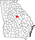 | |
| CDP | ||
| Unincorporated communities | ||
| International | |
|---|---|
| National | |
| Geographic | |
| Other | |
- Milledgeville, Georgia
- 1804 establishments in Georgia (U.S. state)
- Cities in Baldwin County, Georgia
- Cities in Georgia (U.S. state)
- County seats in Georgia (U.S. state)
- Former state capitals in the United States
- Milledgeville micropolitan area, Georgia
- Planned communities in the United States
- Populated places established in 1804